What Happened
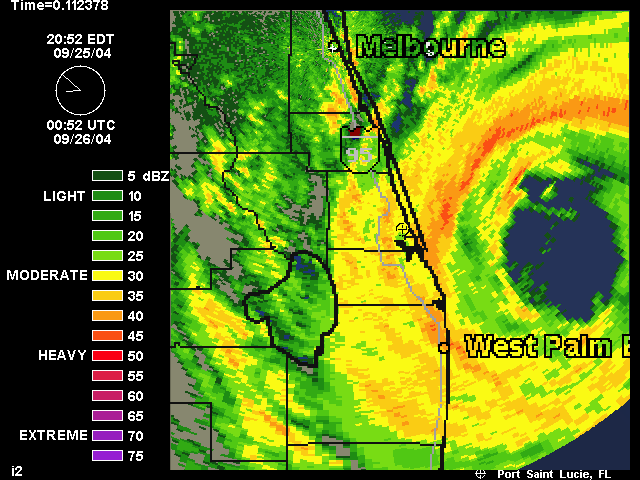
Hurricane Jeanne came ashore on the east coast of Florida just 3 weeks after Frances and only 2 miles north of where Frances first made landfall. She was rated as a catagory 2 hurricane when she first hit land on the Port St. Lucie and Stuart barrier islands. Frances was a very slow moving storm and Jeanne wasn't much faster. Her forward movement of 8 to 10 miles an hour meant we in Port St. Lucie Florida had hurricance force winds for about 16 hours. Where the webmaster lives the winds hit that speed about 5 or 6 in the afternoon and lasted until 1 in the morning when the eye came over us. We went outside to take a quick survey of the damages and again we were rather impressed with how well the neighborhood was holding up. When the winds picked up again nearly 2 1/2 hours after we entered the eye of the storm they were just as strong as what we had before the eye reached us and continued real strong until about noon.